


Noaa Wrecks & Obstructions MGR app for iPhone and iPad
Developer: Mac George Roberts
First release : 15 Apr 2015
App size: 25 Mb
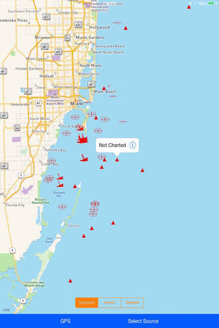
New “Ship Wrecks and Obstructions” map of the US Marine Waters.
Useful for Boaters, Sailors, Mariners, Fishermen…..!
It is highly important for every sailor or boater to consider the under water obstacles that may come in contact with the sailing vessel or a ship while navigating in the sea. And also knowing the spots where these ship wrecks and obstructions are present underneath the water throughout the route would save you, your team and vessel from dangerous hazards and helps navigation more safer.
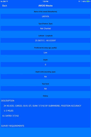
All ship wrecks and obstructions data is derived from official sources NOAA & Automated Wrecks and Obstructions Information System (AWOIS).
Each source provides a series of attributes and description of every wreck or obstruction feature for clearer understanding. Our efforts have been included to make this map more useful by providing information in a user-intuitive style to be able to view each source separately and comparatively.
With the GPS active on the move, the boater can manage the respective obstructions and wrecks of both the sources and can navigate in a safer course.
Disclaimer:
This app is not for Navigation